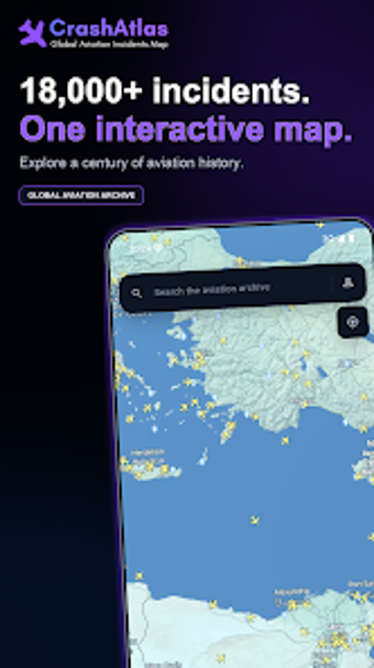
Interactive global archive of aviation accidents for researchers and historians
Plots over 18,000 verified aviation accidents on an interactive world map, letting users zoom, inspect incident pages, and apply detailed filters. CrashAtlas, from Fijisquare, targets travel-navigation research and historical study on Android. It pairs a 3D globe view and powerful search to reveal patterns across a century of events, and includes a daily historical highlight. The app suits aviation enthusiasts, safety researchers, and historians who need a factual, browsable archive for study and reference.
What the app maps and how you navigate it
CrashAtlas visualizes aviation events geographically through an interactive world map and a 3D globe, where you can zoom to regions and open detailed incident pages. Each entry links to statistics, flight paths, and photos when available, and a Daily section lists the three deadliest accidents on the current calendar date. The interface groups scattered historical records into an organised visual workspace for exploration and comparative reading.
How accurate and current the incident data is
Data is presented as verified records, with the database covering more than 18,000 events drawn from public flight safety records and cross-checked for factual accuracy. The app’s archive spans over a century of aviation history, and the developer states the database receives regular updates as new incidents are verified, which supports longitudinal study of safety trends and historical research.
Device compatibility and how the app is delivered
CrashAtlas runs on Android devices and is available via the Google Play Store, requiring no special hardware beyond a compatible mobile device. The installation follows ordinary app delivery channels for mobile, and the developer’s background in data-driven mobile tools indicates the project is designed as a native mobile archive rather than a desktop research platform.
Who it's for and limits on acceptable use
The app serves researchers, enthusiasts, and students who need a factual, browsable record of aviation incidents rather than investigative tools. It presents sensitive historical data in a neutral tone and is intended for study and reference. Users are responsible for ensuring their use complies with applicable platform terms and local regulations when interpreting or republishing the material.
Practical judgement on suitability and context
CrashAtlas is a practical reference for aviation researchers and history-minded users who want an accessible, factual archive backed by Fijisquare’s data-focused approach. Expect a mobile-first, map-centred exploration rather than investigative workflows tied to external databases. Users should check verification needs for formal research and ensure any reuse follows platform terms and local rules before publication.